Bunjils Shelter is a popular attraction in the Grampians, and is one of the country’s most important Aboriginal Art sites.
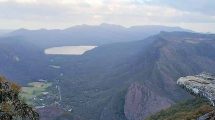
To appreciate the significance of this attraction, it helps to know that the Grampians region has long been associated with the Aboriginal people.
Bunjils Shelter, Grampians History, Age & Location Map, Stawell Victoria
The age of the painting is not known, although pigments of the paint used have been tested. It is estimated that the painting is thousands of years old.
To get to the shelter, take the turnoff on the Stawell Pomonal Road about seven kilometres from Stawell. Take the Bunjil Cave Road (this is a one way road that leads up to four kilometres to the parking area). From the parking space, the shelter is about 100 metres away.
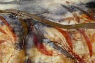
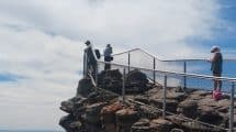
Look out for the huge boulder as this is where the painting is housed. You will notice that the painting features an image of Bunjil alongside two creatures (traditionally referred to as dingos) who were his helpers. The paintings are enclosed in a large metal cage in order to protect them from damage.
So come and visit with this amazing historic piece of art whilst you explore the beautiful Grampians region.


















Where does the one way Bunjils Cave Road come out, what’s the road surface like, and how long is a Stawell return trip? Thankyou.
Hi Andrew,
There are a few parts to your question, so let me answer each part below:
Where does the one way Bunjils Cave Road come out?
The Bunjils Cave Road runs through Black Range Scenic Reserve; turning into Black Range Road, before it runs into the intersection at Bunjils Cave Road. If you follow this north, it will then run back onto the Western Highway.
What’s the road surface like?
It appears to be be a sealed road until around 1.5km after Bunjil’s Shelter, and then it turns into an unsealed road – that’s until about 7km before you get back on the Western Highway (assuming you are following the route above).
How long is a Stawell return trip?
If you are following the route above and not taking into consideration stopping time, it is around 38 mins and 32km in length. I have created the route map below, which shows you the roads:
https://www.google.com.au/maps/dir/Stawell+VIC+3380/-37.1397011,142.7314893/-37.1609073,142.7696281/-37.0583325,142.7756703/@-37.109884,142.7396455,12.48z/data=!4m11!4m10!1m5!1m1!1s0x6ad1de427f802d71:0x40579a430a0b460!2m2!1d142.7753712!2d-37.0575657!1m0!1m0!1m0!3e0?shorturl=1
Alternatively, if you return to Stawell the same way you go to Bunjil’s Shelter, the trip is only 23 mins and 22.5km. You can see the route here:
https://www.google.com.au/maps/dir/Stawell+VIC+3380/Bunjil's+Shelter/Stawell+West+VIC+3380/@-37.0955724,142.7206205,13z/data=!3m1!4b1!4m20!4m19!1m5!1m1!1s0x6ad1de427f802d71:0x40579a430a0b460!2m2!1d142.7753712!2d-37.0575657!1m5!1m1!1s0x6ad1e247b7ac24d1:0x7198331de24dc93a!2m2!1d142.7334148!2d-37.1393782!1m5!1m1!1s0x6ad1c5a5e5239c1d:0x1c0579a7684fc4a0!2m2!1d142.7777088!2d-37.0517769!3e0?shorturl=1
Thanks
Michael
Hi Michael,
Thanks for your detailed response. I was confused by the phrase “this is a one way road … “, but your advice that we can return to Stawell the same way has cleared things up, and we’ll probably visit Bunjils on the way to Horsham (from Apollo Bay) in a few weeks time.
Regards
Andrew Strang